The Parochial Hall and neighbouring buildings, High Street, Kenilworth
Introduction
The photograph on this page of The Parochial Hall and neighbouring buildings, High Street, Kenilworth by John Brightley as part of the Geograph project.
The Geograph project started in 2005 with the aim of publishing, organising and preserving representative images for every square kilometre of Great Britain, Ireland and the Isle of Man.

There are currently over 7.5m images from over 14,400 individuals and you can help contribute to the project by visiting https://www.geograph.org.uk
The Parochial Hall and neighbouring buildings, High Street, Kenilworth
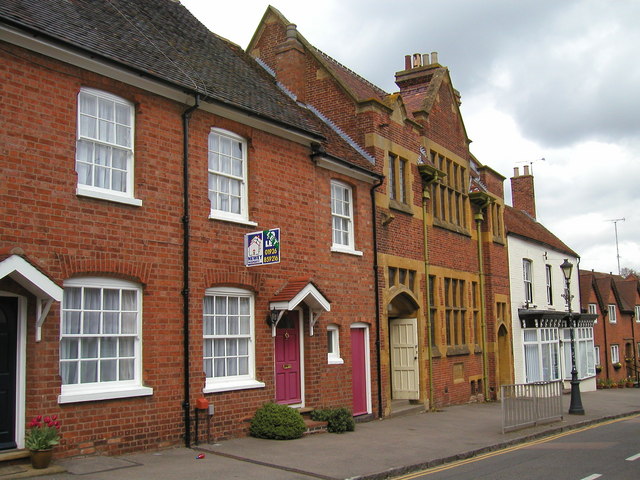
Image: © John Brightley Taken: 20 Apr 2004
The Parochial Hall is the building in the centre of the photograph with stone window surrounds. It acts as the parish hall for St Nicholas church, the entrance to which is across the road, and is the only large community space in this part of the town.
Images are licensed for reuse under creativecommons.org/licenses/by-sa/2.0
Image Location
Latitude
52.349833
Longitude
-1.582873