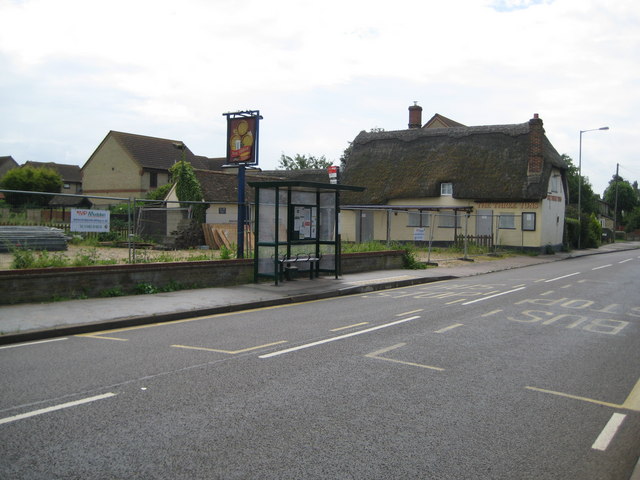
Arlesey: The former Three Tuns
Introduction
The photograph on this page of Arlesey: The former Three Tuns by Nigel Cox as part of the Geograph project.
The Geograph project started in 2005 with the aim of publishing, organising and preserving representative images for every square kilometre of Great Britain, Ireland and the Isle of Man.
There are currently over 7.5m images from over 14,400 individuals and you can help contribute to the project by visiting https://www.geograph.org.uk

Image: © Nigel Cox Taken: 13 Jun 2010
Only a little over four years on from Robin's Image and the pub has joined the remorseless and seemingly irreversible trend of closures. Even the building's Grade II Listed status has failed to save it. The English Heritage Listed Buildings website describes it thus:- "18th Century. Timber framed construction with colourwashed roughcast render. Thatched roof, half-hipped to W end. 3-room plan, one storey and attics, gable end to road. Variety of casement windows, all small with glazing bars. Eyebrow dormer to N elevation. 20th Century porch to N elevation. Red brick chimney stacks, one to ridge, one to each gable end. Single storeyed addition adjoins to E gable end, weatherboarded and thatched, with casement windows." The north elevation with the eyebrow dormer is this one. Comparing the older image with this one the other obvious change is the erection of the bus shelter in the period since 2005.

