Beaconsfield: Footpath to Hedgerley
Introduction
The photograph on this page of Beaconsfield: Footpath to Hedgerley by Nigel Cox as part of the Geograph project.
The Geograph project started in 2005 with the aim of publishing, organising and preserving representative images for every square kilometre of Great Britain, Ireland and the Isle of Man.

There are currently over 7.5m images from over 14,400 individuals and you can help contribute to the project by visiting https://www.geograph.org.uk
Beaconsfield: Footpath to Hedgerley
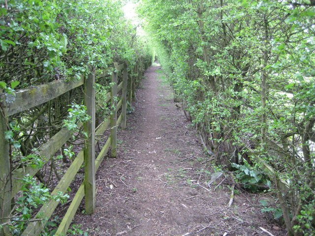
Image: © Nigel Cox Taken: 25 Apr 2010
A green tunnel it might be but this is hardly the most alluring footpath in the Chilterns, passing as it does between the M40 Motorway immediately to the right, and a landfill site, eventually, to the left. However this is a classic illustration of how positional accuracy on maps can be subsumed to the needs of cartography. Here, in order to show the motorway on the Ordnance Survey 1:50,000 scale maps, the footpath route has been shunted some 80 metres north of its true position as shown on more accurate larger scale maps. The circles showing the subject and photographer positions are correct located according to their co-ordinates but then show the photographer standing in the middle of the motorway slip road...!
Images are licensed for reuse under creativecommons.org/licenses/by-sa/2.0
Image Location
Latitude
51.59412
Longitude
-0.62418