Mynediad i Coetmor Farm / Entrance to Coetmor Farm
Introduction
The photograph on this page of Mynediad i Coetmor Farm / Entrance to Coetmor Farm by Ceri Thomas as part of the Geograph project.
The Geograph project started in 2005 with the aim of publishing, organising and preserving representative images for every square kilometre of Great Britain, Ireland and the Isle of Man.

There are currently over 7.5m images from over 14,400 individuals and you can help contribute to the project by visiting https://www.geograph.org.uk
Mynediad i Coetmor Farm / Entrance to Coetmor Farm
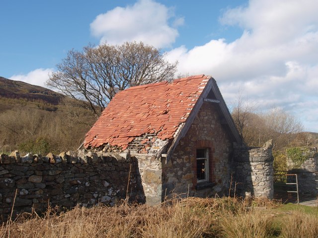
Image: © Ceri Thomas Taken: 25 Apr 2010
From a distance, this building appears like a gatehouse, but on closer inspection, it probably served as a barn. The red tiled roof and prominent gable give it a distinctive appearance.
Images are licensed for reuse under creativecommons.org/licenses/by-sa/2.0
Image Location
Latitude
53.276007
Longitude
-3.859131