Bridge Street
Introduction
The photograph on this page of Bridge Street by David Lally as part of the Geograph project.
The Geograph project started in 2005 with the aim of publishing, organising and preserving representative images for every square kilometre of Great Britain, Ireland and the Isle of Man.

There are currently over 7.5m images from over 14,400 individuals and you can help contribute to the project by visiting https://www.geograph.org.uk
Bridge Street
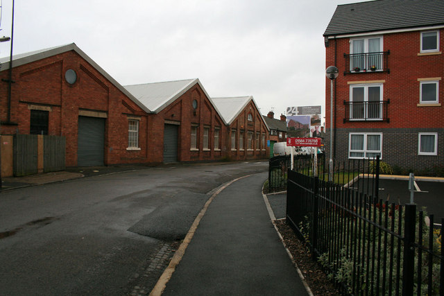
Image: © David Lally Taken: 2 Apr 2010
Goodwin Mills on the left a block of basic apartments apparently called "Waters Edge" on the right. The latter will have been named such due to the fact that the other side is on the west bank of the Erewash Canal http://www.geograph.org.uk/photo/1679092 .
Images are licensed for reuse under creativecommons.org/licenses/by-sa/2.0
Image Location
Latitude
52.903302
Longitude
-1.276367