The Loughshore path at Jordanstown
Introduction
The photograph on this page of The Loughshore path at Jordanstown by Albert Bridge as part of the Geograph project.
The Geograph project started in 2005 with the aim of publishing, organising and preserving representative images for every square kilometre of Great Britain, Ireland and the Isle of Man.

There are currently over 7.5m images from over 14,400 individuals and you can help contribute to the project by visiting https://www.geograph.org.uk
The Loughshore path at Jordanstown
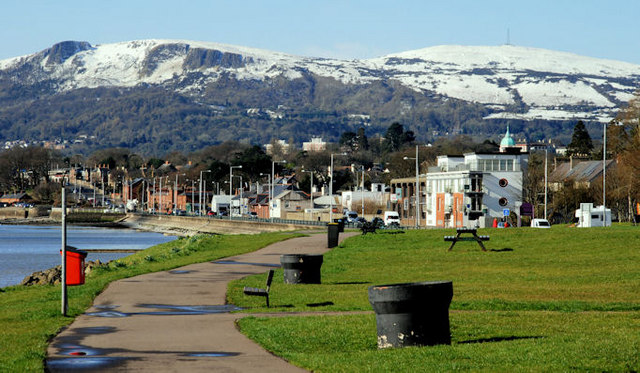
Image: © Albert Bridge Taken: 1 Apr 2010
The path runs from Jordanstown to Whiteabbey between Belfast Lough and the Shore Road. The view is towards Whiteabbey. The Cave Hill Image and Image (background) is still showing Tuesday’s heavy snow which had affected high ground (especially here Image and Image where there were drifts up to five feet deep).
Images are licensed for reuse under creativecommons.org/licenses/by-sa/2.0
Image Location
Latitude
54.679656
Longitude
-5.885103