Aerial view of Scrub Lane and Rectory Road, Hadleigh
Introduction
The photograph on this page of Aerial view of Scrub Lane and Rectory Road, Hadleigh by Edward Clack as part of the Geograph project.
The Geograph project started in 2005 with the aim of publishing, organising and preserving representative images for every square kilometre of Great Britain, Ireland and the Isle of Man.

There are currently over 7.5m images from over 14,400 individuals and you can help contribute to the project by visiting https://www.geograph.org.uk
Aerial view of Scrub Lane and Rectory Road, Hadleigh
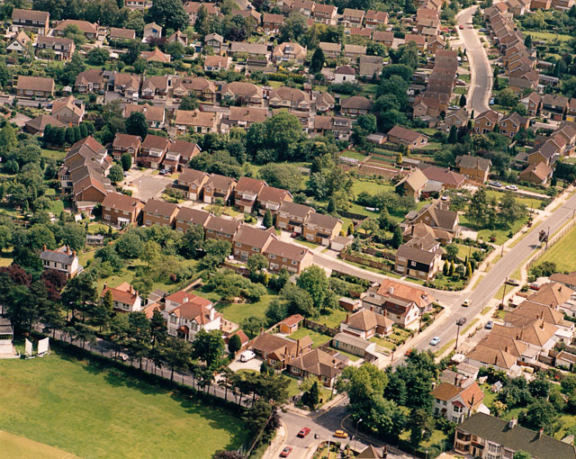
Image: © Edward Clack Taken: 27 Jun 1987
Scrub Lane runs across the lower right of the picture. Rectory Road runs across the lower left. At the junction of these (bottom-centre) there are traffic lights. The green area at the bottom left is the southern part of the John Burrows Recreation Ground.
Images are licensed for reuse under creativecommons.org/licenses/by-sa/2.0
Image Location
Latitude
51.557006
Longitude
0.612468