Aberayron station
Introduction
The photograph on this page of Aberayron station by Ben Brooksbank as part of the Geograph project.
The Geograph project started in 2005 with the aim of publishing, organising and preserving representative images for every square kilometre of Great Britain, Ireland and the Isle of Man.

There are currently over 7.5m images from over 14,400 individuals and you can help contribute to the project by visiting https://www.geograph.org.uk
Aberayron station
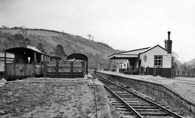
Image: © Ben Brooksbank Taken: 6 Apr 1958
View SE (away from buffers) of terminus of branch from Lampeter, seven years since closure to passengers, but still open for goods (and milk) until 5 April 1965.
Images are licensed for reuse under creativecommons.org/licenses/by-sa/2.0
Image Location
Latitude
52.236647
Longitude
-4.257387