The road from South Kiscadale
Introduction
The photograph on this page of The road from South Kiscadale by Alan Walker as part of the Geograph project.
The Geograph project started in 2005 with the aim of publishing, organising and preserving representative images for every square kilometre of Great Britain, Ireland and the Isle of Man.

There are currently over 7.5m images from over 14,400 individuals and you can help contribute to the project by visiting https://www.geograph.org.uk
The road from South Kiscadale
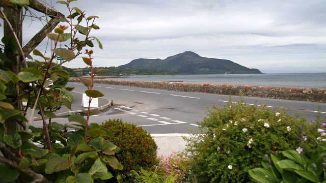
Image: © Alan Walker Taken: 27 Jun 2008
This photograph of the A481 (ahead from the right) through Whiting Bay was taken from the garden of ‘The Coffee Pot’ at its junction with the road from South Kiscadale (from the left). In the distance can be seen the Kingscross headland and beyond that Holy Island. For a photograph of the seashore at Whiting Bay taken from the wall across the road, click here: http://www.geograph.org.uk/photo/1737103 . For another photograph (1986) of the A481 about 0,5km north of this point, click here: http://www.geograph.org.uk/photo/1737058 . - - - See also this photograph by Gordon Brown: Image
Images are licensed for reuse under creativecommons.org/licenses/by-sa/2.0
Image Location
Latitude
55.485227
Longitude
-5.093738