Bromesberrow Place
Introduction
The photograph on this page of Bromesberrow Place by Philip Halling as part of the Geograph project.
The Geograph project started in 2005 with the aim of publishing, organising and preserving representative images for every square kilometre of Great Britain, Ireland and the Isle of Man.

There are currently over 7.5m images from over 14,400 individuals and you can help contribute to the project by visiting https://www.geograph.org.uk
Bromesberrow Place
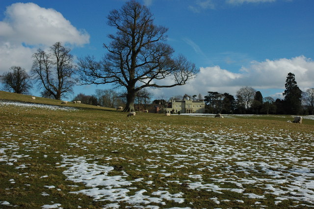
Image: © Philip Halling Taken: 21 Feb 2010
Bromesberrow Place viewed from a footpath passing through Bromesberrow Estate. Pevsner informs that this was originally a farmhouse called Hooke House which remodelled around 1768-72 for the Yate family, possibly to a design of Ferdinando Stratford.
Images are licensed for reuse under creativecommons.org/licenses/by-sa/2.0
Image Location
Latitude
52.006419
Longitude
-2.354981