The end of the line
Introduction
The photograph on this page of The end of the line by Alan Walker as part of the Geograph project.
The Geograph project started in 2005 with the aim of publishing, organising and preserving representative images for every square kilometre of Great Britain, Ireland and the Isle of Man.

There are currently over 7.5m images from over 14,400 individuals and you can help contribute to the project by visiting https://www.geograph.org.uk
The end of the line
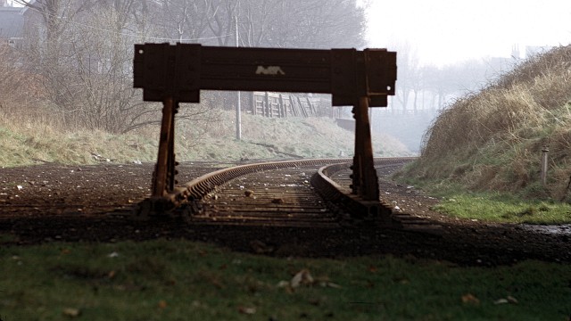
Image: © Alan Walker Taken: Unknown
In 1972 this was all that remained of the southern end of the Whitby to Scarborough railway line – the head of a virtually unused siding. These buffers were under Woodland Ravine railway bridge. To the left and ahead is Manor Road and to the right a park. The data given for the date taken is the processing date on the slide and therefore could have been taken several weeks earlier.
Images are licensed for reuse under creativecommons.org/licenses/by-sa/2.0
Image Location
Latitude
54.282312
Longitude
-0.419738