The church at Ditteridge
Introduction
The photograph on this page of The church at Ditteridge by Phil Williams as part of the Geograph project.
The Geograph project started in 2005 with the aim of publishing, organising and preserving representative images for every square kilometre of Great Britain, Ireland and the Isle of Man.

There are currently over 7.5m images from over 14,400 individuals and you can help contribute to the project by visiting https://www.geograph.org.uk
The church at Ditteridge
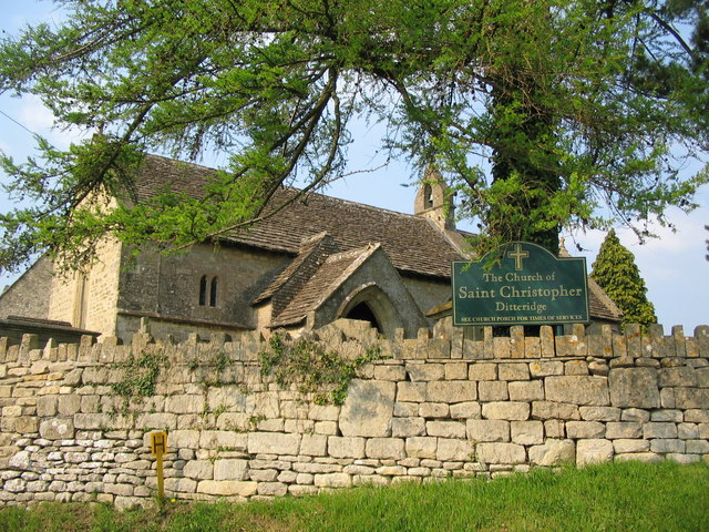
Image: © Phil Williams Taken: 10 May 2006
A view looking north to the parish church of St. Christopher. The present church dates from around 1100, the earliest part being the early Norman nave which is built of stone rubble. A chancel was added in the 13th century, and a south porch in the 14th century. The church contains a Norman font and has a Norman arch headed window to the east of the porch. A unique 13th century piscina can be found on the interior of the south wall.
Images are licensed for reuse under creativecommons.org/licenses/by-sa/2.0
Image Location
Latitude
51.424213
Longitude
-2.263148