Railways, Kilmarnock
Introduction
The photograph on this page of Railways, Kilmarnock by Richard Webb as part of the Geograph project.
The Geograph project started in 2005 with the aim of publishing, organising and preserving representative images for every square kilometre of Great Britain, Ireland and the Isle of Man.

There are currently over 7.5m images from over 14,400 individuals and you can help contribute to the project by visiting https://www.geograph.org.uk
Railways, Kilmarnock
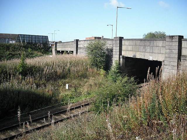
Image: © Richard Webb Taken: 9 Sep 2009
A bridge takes the B7064 over the trackbeds of two railways. The nearer line is still open and was the Glasgow and Kilmarnock Joint Railway running to Glasgow via Stewarton. This was operated by the Caledonian Railway The further arch crosses the now closed Glasgow, Paisley, Kilmarnock and Ayr Railway a rival line operated by the Glasgow and South Western via Dalry. The Glasgow, Paisley, Kilmarnock and Ayr Railway track is still there in places, buried under vegetation. A 1976 map shows it as intact as far as Dalry. The line is now a cycle path, National Cycle Network route 73.
Images are licensed for reuse under creativecommons.org/licenses/by-sa/2.0
Image Location
Latitude
55.61582
Longitude
-4.509196