Local Public Park
Introduction
The photograph on this page of Local Public Park by andrew paterson as part of the Geograph project.
The Geograph project started in 2005 with the aim of publishing, organising and preserving representative images for every square kilometre of Great Britain, Ireland and the Isle of Man.

There are currently over 7.5m images from over 14,400 individuals and you can help contribute to the project by visiting https://www.geograph.org.uk
Local Public Park
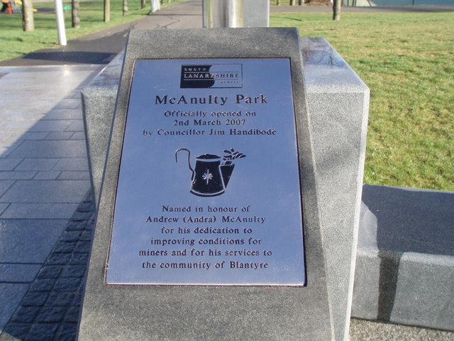
Image: © andrew paterson Taken: 2 Mar 2007
Re-named in honour of Andrew McAnulty for his services to the Community
Images are licensed for reuse under creativecommons.org/licenses/by-sa/2.0
Image Location
Latitude
55.792851
Longitude
-4.098935