Blue Coat Boy pub (site of). 8, Dodds Place (late), Rotherhithe, London, SE16
Introduction
The photograph on this page of Blue Coat Boy pub (site of). 8, Dodds Place (late), Rotherhithe, London, SE16 by Chris Lordan as part of the Geograph project.
The Geograph project started in 2005 with the aim of publishing, organising and preserving representative images for every square kilometre of Great Britain, Ireland and the Isle of Man.

There are currently over 7.5m images from over 14,400 individuals and you can help contribute to the project by visiting https://www.geograph.org.uk
Blue Coat Boy pub (site of). 8, Dodds Place (late), Rotherhithe, London, SE16
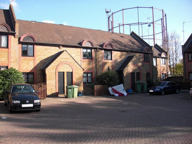
Image: © Chris Lordan Taken: 4 Nov 2009
Dodds Place was once at the east end and slightly north of Adam Street (now Brunel Road), between Canon Beck Road and Kinburn Street. The pub would have stood about the centre of the forecourt shown. It was first recorded in 1767 and destroyed by fire in 1827. In 1830 its licence was refused and it became 8 Dodds Place. It was also known as the 'Dial'.
Images are licensed for reuse under creativecommons.org/licenses/by-sa/2.0
Image Location
Latitude
51.502178
Longitude
-0.050189