Common fields met here once
Introduction
The photograph on this page of Common fields met here once by Michael Dibb as part of the Geograph project.
The Geograph project started in 2005 with the aim of publishing, organising and preserving representative images for every square kilometre of Great Britain, Ireland and the Isle of Man.

There are currently over 7.5m images from over 14,400 individuals and you can help contribute to the project by visiting https://www.geograph.org.uk
Common fields met here once
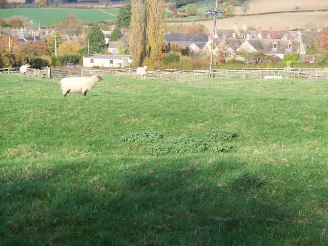
Image: © Michael Dibb Taken: 26 Oct 2009
In the Middle Ages, each village had several common fields. The fields were ploughed in strips creating the "ridge and furrow" pattern so often seen in the North Cotswolds. Here is an excellent example of the boundary between two common fields and the nearest sheep is standing on the boundary. Immediately in front of the camera, this field has been ploughed in an east-west direction whilst beyond the sheep would have been another common field where the ploughing is in a north-south direction.
Images are licensed for reuse under creativecommons.org/licenses/by-sa/2.0
Image Location
Latitude
51.988862
Longitude
-1.582155