Castleton
Introduction
The photograph on this page of Castleton by Stephen Burton as part of the Geograph project.
The Geograph project started in 2005 with the aim of publishing, organising and preserving representative images for every square kilometre of Great Britain, Ireland and the Isle of Man.

There are currently over 7.5m images from over 14,400 individuals and you can help contribute to the project by visiting https://www.geograph.org.uk
Castleton
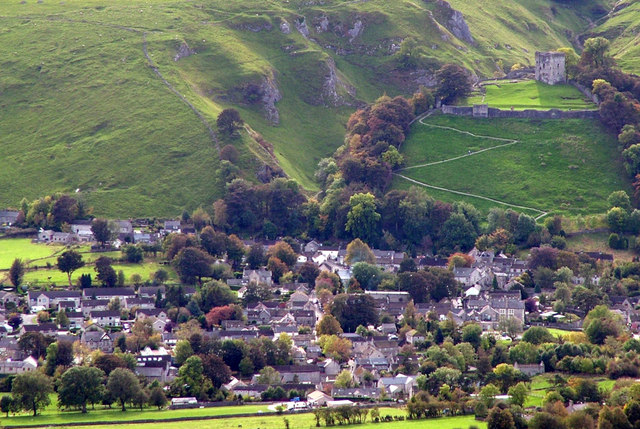
Image: © Stephen Burton Taken: 7 Oct 2009
Castleton photographed from Lose hill. The zigzag path to Peveril Castle can be seen in the top right hand corner, behind the castle are the limestone rocks of Cave Dale.
Images are licensed for reuse under creativecommons.org/licenses/by-sa/2.0
Image Location
Latitude
53.341887
Longitude
-1.774671