Ashprington
Introduction
The photograph on this page of Ashprington by Derek Harper as part of the Geograph project.
The Geograph project started in 2005 with the aim of publishing, organising and preserving representative images for every square kilometre of Great Britain, Ireland and the Isle of Man.

There are currently over 7.5m images from over 14,400 individuals and you can help contribute to the project by visiting https://www.geograph.org.uk
Ashprington
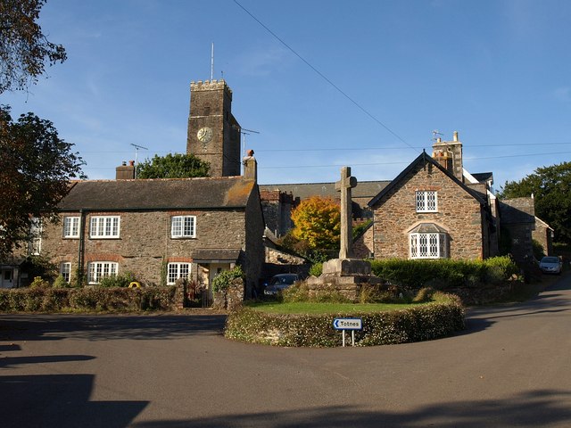
Image: © Derek Harper Taken: 27 Sep 2009
In the foreground is the war memorial shown in Image On the left is the row of estate cottages described at http://www.imagesofengland.org.uk/details/default.aspx?id=100924 . "All the windows are in their C19 openings with red brick cambered arches." To the right is Corner Cottage with "original 2-light casements with lozenge and diamond-shaped panes" http://www.imagesofengland.org.uk/Details/Default.aspx?id=100925&mode=adv . "Ashprington is the estate village of Sharpham House". Behind is Image
Images are licensed for reuse under creativecommons.org/licenses/by-sa/2.0
Image Location
Latitude
50.400956
Longitude
-3.664515