Ringway (now Manchester) Airport
Introduction
The photograph on this page of Ringway (now Manchester) Airport by John Rostron as part of the Geograph project.
The Geograph project started in 2005 with the aim of publishing, organising and preserving representative images for every square kilometre of Great Britain, Ireland and the Isle of Man.

There are currently over 7.5m images from over 14,400 individuals and you can help contribute to the project by visiting https://www.geograph.org.uk
Ringway (now Manchester) Airport
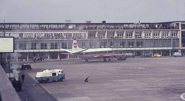
Image: © John Rostron Taken: Unknown
These photos were taken in 1976 just before the great re-development of Ringway to become Manchester International Airport. I am assuming that the pier from which this was taken (just visible to the bottom left and in Image) corresponds to the one on the current map, and that Terminal One corresponds to the building visible here.
Images are licensed for reuse under creativecommons.org/licenses/by-sa/2.0
Image Location
Latitude
53.361023
Longitude
-2.272683