Black Roof House, Knatchbull Road
Introduction
The photograph on this page of Black Roof House, Knatchbull Road by Stephen Craven as part of the Geograph project.
The Geograph project started in 2005 with the aim of publishing, organising and preserving representative images for every square kilometre of Great Britain, Ireland and the Isle of Man.

There are currently over 7.5m images from over 14,400 individuals and you can help contribute to the project by visiting https://www.geograph.org.uk
Black Roof House, Knatchbull Road
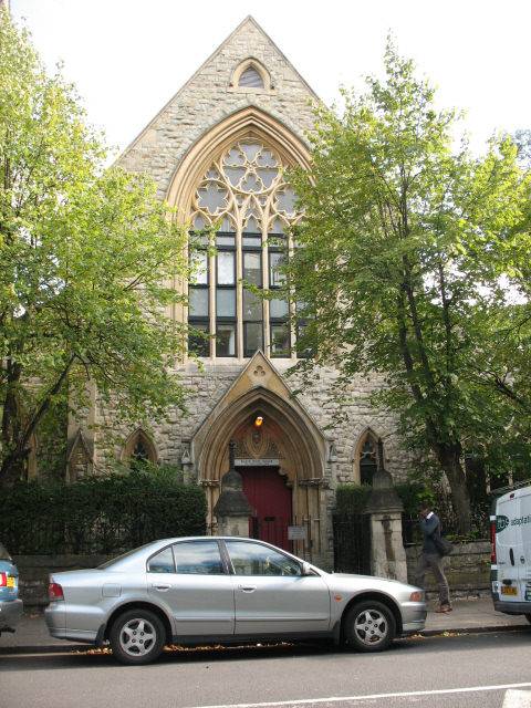
Image: © Stephen Craven Taken: 22 Sep 2009
This building was formerly the Church of St James the Apostle. It was declared redundant in 1981 and leased in 1982 to the SCD (Society for Co-operative Dwellings) for conversion to residential use as "Black Roof House" - which was still going under that name at 2009. The building is now surrounded by trees and a fence which make it difficult to get a good view, but the spire Image is still a local landmark. The building is listed grade 2.
Images are licensed for reuse under creativecommons.org/licenses/by-sa/2.0
Image Location
Latitude
51.472651
Longitude
-0.103142