Baillieston, Muirhead Road Viaduct
Introduction
The photograph on this page of Baillieston, Muirhead Road Viaduct by Robert Murray as part of the Geograph project.
The Geograph project started in 2005 with the aim of publishing, organising and preserving representative images for every square kilometre of Great Britain, Ireland and the Isle of Man.

There are currently over 7.5m images from over 14,400 individuals and you can help contribute to the project by visiting https://www.geograph.org.uk
Baillieston, Muirhead Road Viaduct
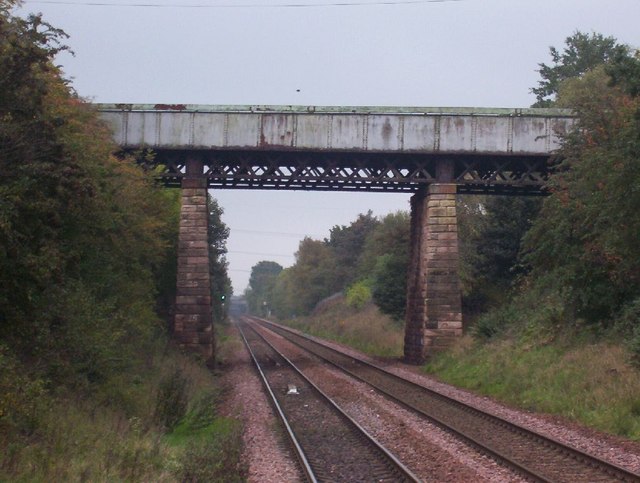
Image: © Robert Murray Taken: 4 Jul 2007
Built in 1864 and still taking traffic - albeit restricted to one lane in recent years. Keen observers will note the right hand (southern) pier is thicker than the left (northern). The structure was built lop sided with the low end at the Hangman's Brae side where the road was cut out of the hill to reduce the severity of the gradient to assist horse drawn traffic.
Images are licensed for reuse under creativecommons.org/licenses/by-sa/2.0
Image Location
Latitude
55.84476
Longitude
-4.111636