Street map, Belfast
Introduction
The photograph on this page of Street map, Belfast by Albert Bridge as part of the Geograph project.
The Geograph project started in 2005 with the aim of publishing, organising and preserving representative images for every square kilometre of Great Britain, Ireland and the Isle of Man.

There are currently over 7.5m images from over 14,400 individuals and you can help contribute to the project by visiting https://www.geograph.org.uk
Street map, Belfast
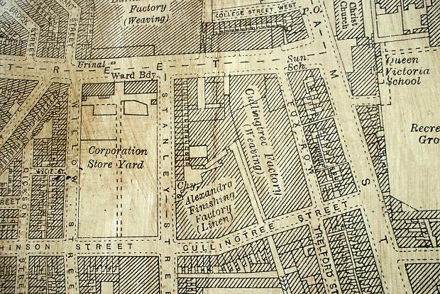
Image: © Albert Bridge Taken: 6 Sep 2009
Not a conventional street map but a section from a much larger Victorian 25” map. It is on a hoarding around a vacant site in Castle Street. Part of the area shown was cleared for the Westlink Image One remaining reference point is Christ Church Image at top right.
Images are licensed for reuse under creativecommons.org/licenses/by-sa/2.0
Image Location
Latitude
54.599355
Longitude
-5.933374