Conduit Mews
Introduction
The photograph on this page of Conduit Mews by Martin Addison as part of the Geograph project.
The Geograph project started in 2005 with the aim of publishing, organising and preserving representative images for every square kilometre of Great Britain, Ireland and the Isle of Man.

There are currently over 7.5m images from over 14,400 individuals and you can help contribute to the project by visiting https://www.geograph.org.uk
Conduit Mews
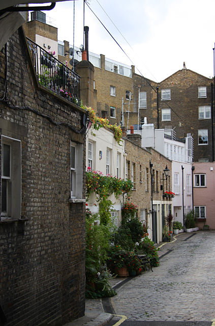
Image: © Martin Addison Taken: 25 Aug 2009
Connecting Spring Street with Craven Road - see Image by D.Johnston for the view from the Craven Road end. Mews' within the Paddington area were built to provide stabling for the horses of the residents with living quarters for their servants. Most have since been converted into houses.
Images are licensed for reuse under creativecommons.org/licenses/by-sa/2.0
Image Location
Latitude
51.514241
Longitude
-0.175624