The Withies pub sign, Withies Lane
Introduction
The photograph on this page of The Withies pub sign, Withies Lane by P L Chadwick as part of the Geograph project.
The Geograph project started in 2005 with the aim of publishing, organising and preserving representative images for every square kilometre of Great Britain, Ireland and the Isle of Man.

There are currently over 7.5m images from over 14,400 individuals and you can help contribute to the project by visiting https://www.geograph.org.uk
The Withies pub sign, Withies Lane
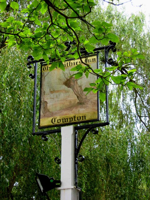
Image: © P L Chadwick Taken: 24 Aug 2009
The Withies is a popular 16th century pub with restaurant. Although not as old as the pub, the sign seems to have been there for a good many years, and is quite faded. The other side is even more difficult to decipher. According to Wikipedia, a withy is the name given to strong flexible willow stems that are typically used in thatching and for gardening. It seems quite possible that the pub has been known as The Withies throughout its long history. Image; Image
Images are licensed for reuse under creativecommons.org/licenses/by-sa/2.0
Image Location


Leaflet Map data © OpenStreetMap
Latitude
51.212105
Longitude
-0.62185