Brownhill Junction
Introduction
The photograph on this page of Brownhill Junction by Richard Webb as part of the Geograph project.
The Geograph project started in 2005 with the aim of publishing, organising and preserving representative images for every square kilometre of Great Britain, Ireland and the Isle of Man.

There are currently over 7.5m images from over 14,400 individuals and you can help contribute to the project by visiting https://www.geograph.org.uk
Brownhill Junction
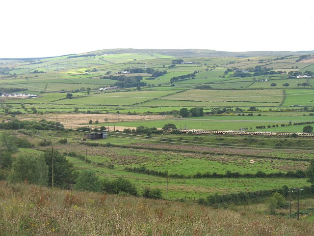
Image: © Richard Webb Taken: 13 Aug 2009
Looking down into the Garnock Valley with a train heading towards Ayr. The train is passing the site of Brownhill Junction where the Lochwinnoch Loop left the original line (the one still in use) to run up the western side of the lochs. The loop line was built in 1905 to add extra capacity. It closed to passengers in 1966 and freight over the following years. A short stretch remained into the 1970s to serve Glengarnock Steel works, and appears on my 1976 Ordnance Survey map. The route divided again in Dalry with one line to Irvine and another, now lifted to Kilmarnock. Between Brownhill Junction and Dalry the bottleneck was prevented by a quadruple track. The land in the foreground is rashy and of poorer quality to most of the land around here.
Images are licensed for reuse under creativecommons.org/licenses/by-sa/2.0
Image Location
Latitude
55.728444
Longitude
-4.691627