Information board at Brunel Woods
Introduction
The photograph on this page of Information board at Brunel Woods by Derek Harper as part of the Geograph project.
The Geograph project started in 2005 with the aim of publishing, organising and preserving representative images for every square kilometre of Great Britain, Ireland and the Isle of Man.

There are currently over 7.5m images from over 14,400 individuals and you can help contribute to the project by visiting https://www.geograph.org.uk
Information board at Brunel Woods
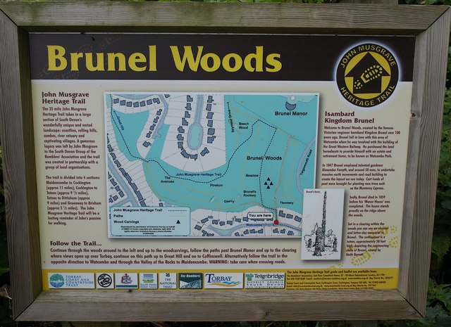
Image: © Derek Harper Taken: 9 Jun 2009
This board can be partly seen to the left of the gate in Image It describes the John Musgrave Heritage Trail and its route in this area, and Isambard Kingdom Brunel's association with the site.
Images are licensed for reuse under creativecommons.org/licenses/by-sa/2.0
Image Location
Latitude
50.497452
Longitude
-3.527327