Marsh Lane Narrows, near Wolverhampton
Introduction
The photograph on this page of Marsh Lane Narrows, near Wolverhampton by Roger D Kidd as part of the Geograph project.
The Geograph project started in 2005 with the aim of publishing, organising and preserving representative images for every square kilometre of Great Britain, Ireland and the Isle of Man.

There are currently over 7.5m images from over 14,400 individuals and you can help contribute to the project by visiting https://www.geograph.org.uk
Marsh Lane Narrows, near Wolverhampton
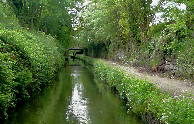
Image: © Roger D Kidd Taken: 19 May 2009
The Staffordshire and Worcestershire Canal approaching Forster Bridge, No 68. The narrows are cut into the sandstone rock, and for half a mile or so narrowboats cannot pass each other. There are two wider spots in the narrows where one (maybe two) boat(s) can pass another coming the other way. This picture shows the southern one. The latest Nicholson Guide mentions that locally the stretch is called "Pendeford Rockin'", after a local farm. The white blossom on the trees is Hawthorn, or Mayflower.
Images are licensed for reuse under creativecommons.org/licenses/by-sa/2.0
Image Location
Latitude
52.630256
Longitude
-2.136473