Nottingham Irish Centre
Introduction
The photograph on this page of Nottingham Irish Centre by David Lally as part of the Geograph project.
The Geograph project started in 2005 with the aim of publishing, organising and preserving representative images for every square kilometre of Great Britain, Ireland and the Isle of Man.

There are currently over 7.5m images from over 14,400 individuals and you can help contribute to the project by visiting https://www.geograph.org.uk
Nottingham Irish Centre
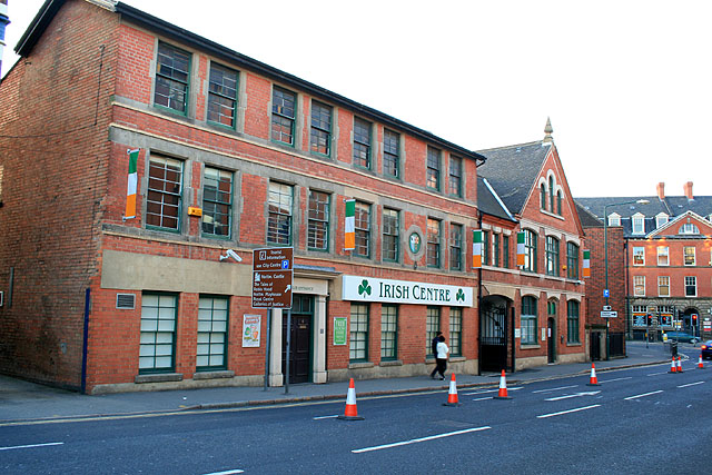
Image: © David Lally Taken: 19 Apr 2009
On Wilford Road. In the late 1970s when the IRA was still in the habit of planting bombs on the British mainland a fellow student of mine ran a mobile disco, he was studying mining engineering and took holiday jobs in the Nottinghamshire coalfield. I am not sure how it came about but one night he had a booking here at the Irish Centre and I helped him with the set-up. We were on our second or third trip up the stairs and carrying his boxes of 6" singles, when he suddenly stopped in front of me and I nearly fell over him. "What's up?" I said. "Where are we?" said he. "The Irish Centre" "What does it say on these boxes?" I looked for the first time at the markings on these boxes I was carrying, so well sized for singles that I had never thought that they might have been designed to carry anything else. "Nobel Explosives" I said.
Images are licensed for reuse under creativecommons.org/licenses/by-sa/2.0
Image Location
Latitude
52.948108
Longitude
-1.15157