Nisbet Hill Doocot
Introduction
The photograph on this page of Nisbet Hill Doocot by Walter Baxter as part of the Geograph project.
The Geograph project started in 2005 with the aim of publishing, organising and preserving representative images for every square kilometre of Great Britain, Ireland and the Isle of Man.

There are currently over 7.5m images from over 14,400 individuals and you can help contribute to the project by visiting https://www.geograph.org.uk
Nisbet Hill Doocot
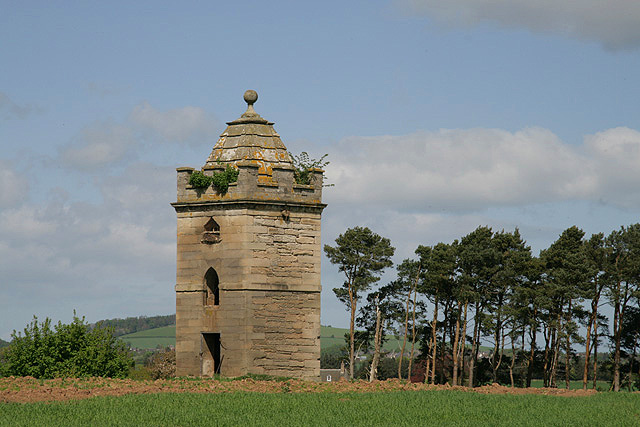
Image: © Walter Baxter Taken: 2 May 2009
This late 18th century doocot, with its unique pentagonal plan, has a crenellated parapet and ribbed stone roof.
Images are licensed for reuse under creativecommons.org/licenses/by-sa/2.0
Image Location
Latitude
55.748432
Longitude
-2.325586