River Hull from Hallimanwath Bridge
Introduction
The photograph on this page of River Hull from Hallimanwath Bridge by Peter Church as part of the Geograph project.
The Geograph project started in 2005 with the aim of publishing, organising and preserving representative images for every square kilometre of Great Britain, Ireland and the Isle of Man.

There are currently over 7.5m images from over 14,400 individuals and you can help contribute to the project by visiting https://www.geograph.org.uk
River Hull from Hallimanwath Bridge
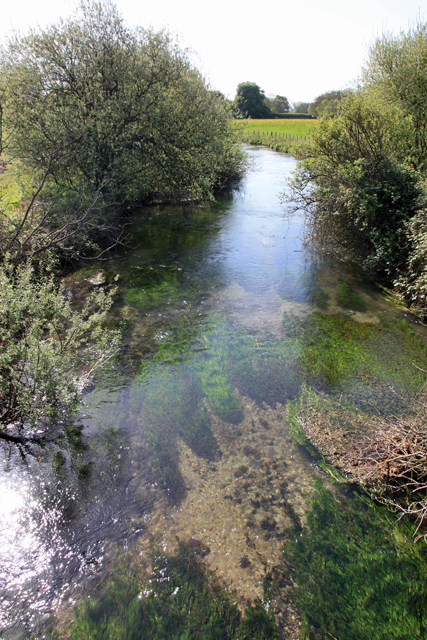
Image: © Peter Church Taken: 2 May 2009
This photograph was taken facing south-east, the direction in which water is flowing. The water was beautifully clear and inviting. The river Hull is fed from springs rising in the chalk of the Yorkshire Wolds and flowing gently south through the river Hull basin. The river here is 16 metres above mean sea level, and has 20 miles to run before it reaches the Humber.
Images are licensed for reuse under creativecommons.org/licenses/by-sa/2.0
Image Location
Latitude
53.995903
Longitude
-0.444639