M10 Motorway (1959 - 2009)
Introduction
The photograph on this page of M10 Motorway (1959 - 2009) by Nigel Cox as part of the Geograph project.
The Geograph project started in 2005 with the aim of publishing, organising and preserving representative images for every square kilometre of Great Britain, Ireland and the Isle of Man.

There are currently over 7.5m images from over 14,400 individuals and you can help contribute to the project by visiting https://www.geograph.org.uk
M10 Motorway (1959 - 2009)
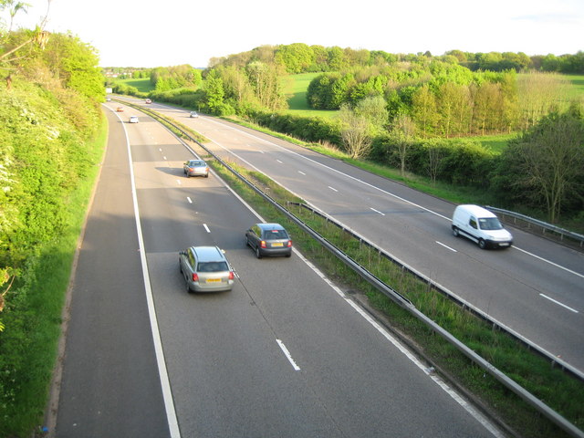
Image: © Nigel Cox Taken: 29 Apr 2009
On the penultimate day of its operation before being downgraded to an A road, this is the M10 Motorway viewed looking towards the Parkstreet roundabout from the B4630 Watford Road bridge. The motorway was built in 1959 as a distributor spur to assist in the dispersal of southbound traffic on the M1 into the ordinary road system, without causing a bottleneck at one point. Before the M1 was eventually extended northwards the M45 was designed and built to perform a similar role at the M1's then northern end. The downgrading, plus the redesigning of Junctions 7 and 8 of the M1 during the recently completed widening, will now allow non-motorway traffic to travel between Hemel Hempstead and St Albans along an A grade road. For the BBC News report please see http://news.bbc.co.uk/1/hi/england/beds/bucks/herts/8013941.stm
Images are licensed for reuse under creativecommons.org/licenses/by-sa/2.0
Image Location
Latitude
51.734857
Longitude
-0.35272