Garreg filltir/Mile stone
Introduction
The photograph on this page of Garreg filltir/Mile stone by G Williams as part of the Geograph project.
The Geograph project started in 2005 with the aim of publishing, organising and preserving representative images for every square kilometre of Great Britain, Ireland and the Isle of Man.

There are currently over 7.5m images from over 14,400 individuals and you can help contribute to the project by visiting https://www.geograph.org.uk
Garreg filltir/Mile stone
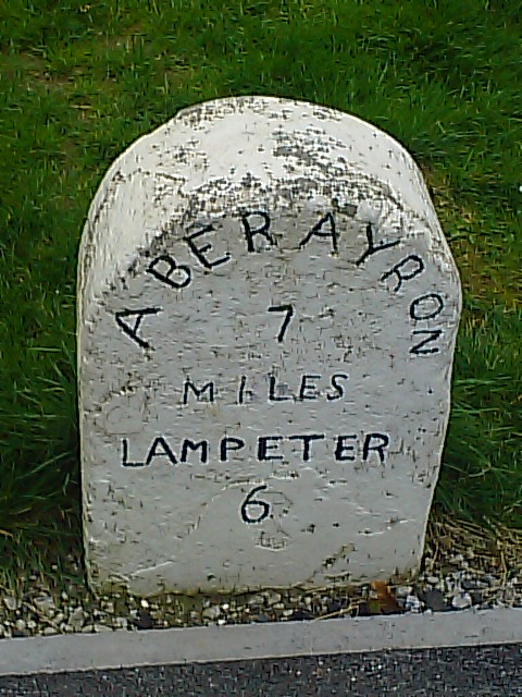
Image: © G Williams Taken: 24 Apr 2009
Garreg filltir Aberayron (Aberaeron) i Lampeter (Llanpedr Pont Steffan/Llambed) ar sgwar Felinfach, wrth ymyl yr Arosfan bws iawn. Ar y A482 yn edrych dros yr cyffordd B4342 i Talsarn (Tal-sarn) a Image Aberayron (Aberaeron) to Lampeter (Llanpedr Pont Steffan/Llambed) mile stone on Felinfach square, next to the proper Bus Shelter. On the A482 overlooking the B4342 to Tal-sarn (Talsarn) junction and Image Golygfeydd cyfagos Image a Image Views nearby Image and Image
Images are licensed for reuse under creativecommons.org/licenses/by-sa/2.0
Image Location
Latitude
52.179721
Longitude
-4.151393