Radlett: Accommodation bridge under the railway
Introduction
The photograph on this page of Radlett: Accommodation bridge under the railway by Nigel Cox as part of the Geograph project.
The Geograph project started in 2005 with the aim of publishing, organising and preserving representative images for every square kilometre of Great Britain, Ireland and the Isle of Man.

There are currently over 7.5m images from over 14,400 individuals and you can help contribute to the project by visiting https://www.geograph.org.uk
Radlett: Accommodation bridge under the railway
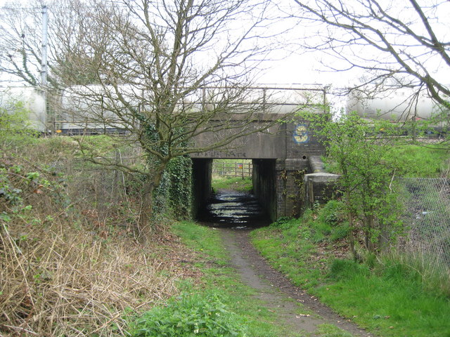
Image: © Nigel Cox Taken: 15 Apr 2009
This small accommodation bridge allows the public footpath between Watling Street and Theobald Street to pass under the railway. Passing across the bridge is an unusual southbound freight train made up of grey tankers. Fast as they may be, scheduling these trains into the intense suburban train timetable along the Midland main line must be a challenge. A glance at the Ordnance Survey's 1:50,000 scale mapping in this grid square reveals a bit of cartographic licence, with this bridge and the nearby Image giving the impression of being one continuous structure about a hundred metres long!
Images are licensed for reuse under creativecommons.org/licenses/by-sa/2.0
Image Location
Latitude
51.679235
Longitude
-0.311057