Chantries, Bredgar
Introduction
The photograph on this page of Chantries, Bredgar by Penny Mayes as part of the Geograph project.
The Geograph project started in 2005 with the aim of publishing, organising and preserving representative images for every square kilometre of Great Britain, Ireland and the Isle of Man.

There are currently over 7.5m images from over 14,400 individuals and you can help contribute to the project by visiting https://www.geograph.org.uk
Chantries, Bredgar
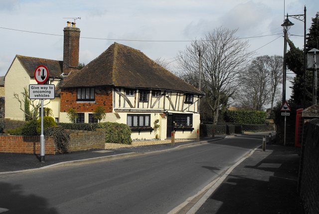
Image: © Penny Mayes Taken: 23 Mar 2009
When I first heard about the proposed traffic calming measures in The Street, Bredgar I assumed the pavement as it passes Chantries would be widened to allow the passage of pushchairs, wheelchairs etc. This might have been the case if they hadn't also installed wooden bollards... I am completely baffled by the installation of the very tall street lamp on the right. It's quite attractive but there is already a lantern on the church gate as well as the illumination of the church tower (out of shot, right). A local resident told me it had not yet been switched on. I lived in this house for 30 years until July 2007. I'm told the current owner has applied for permission to reinstate the front wall (seen in this shot http://www.geograph.org.uk/photo/98496 ) Update - wall has now been rebuilt http://www.geograph.org.uk/photo/1449547 but has lost the curved corner it used to have and is considerably higher. Listing details http://list.english-heritage.org.uk/resultsingle.aspx?uid=1299311
Images are licensed for reuse under creativecommons.org/licenses/by-sa/2.0
Image Location
Latitude
51.311123
Longitude
0.695624