Round Chimneys Farmhouse
Introduction
The photograph on this page of Round Chimneys Farmhouse by Mike Searle as part of the Geograph project.
The Geograph project started in 2005 with the aim of publishing, organising and preserving representative images for every square kilometre of Great Britain, Ireland and the Isle of Man.

There are currently over 7.5m images from over 14,400 individuals and you can help contribute to the project by visiting https://www.geograph.org.uk
Round Chimneys Farmhouse
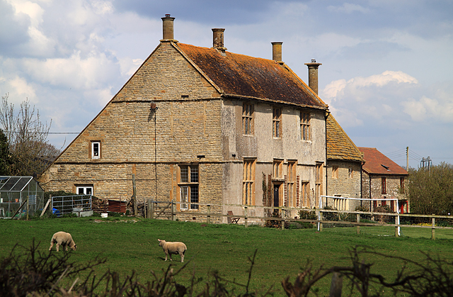
Image: © Mike Searle Taken: 5 Apr 2009
A close view of this grade II* listed farmhouse shows clearly why it was so named. Its interesting history is recorded under a previous image Image .
Images are licensed for reuse under creativecommons.org/licenses/by-sa/2.0
Image Location


Leaflet Map data © OpenStreetMap
Latitude
50.883654
Longitude
-2.454411