Rookhope village
Introduction
The photograph on this page of Rookhope village by Andrew Curtis as part of the Geograph project.
The Geograph project started in 2005 with the aim of publishing, organising and preserving representative images for every square kilometre of Great Britain, Ireland and the Isle of Man.

There are currently over 7.5m images from over 14,400 individuals and you can help contribute to the project by visiting https://www.geograph.org.uk
Rookhope village
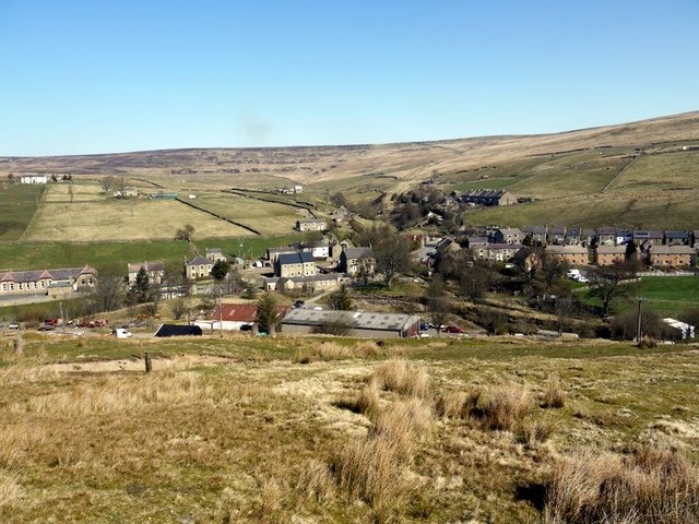
Image: © Andrew Curtis Taken: 3 Apr 2009
The lead mining community of Rookhope took its name from the valley and grew up from the originally separate settlements of Boltsburn and Stotsfield. The history of mining in this area is given in http://www.pastperfect.org.uk/sites/oldrookhope/index.html The poet WH Auden was inspired by the decaying industrial heritage in this area. In a letter to Lord Byron (1937) he states: "Tramlines and slagheaps, pieces of machinery. That was, and still is, my ideal scenery."
Images are licensed for reuse under creativecommons.org/licenses/by-sa/2.0
Image Location
Latitude
54.781238
Longitude
-2.09652