Kings Road Subway
Introduction
The photograph on this page of Kings Road Subway by Richard Kay as part of the Geograph project.
The Geograph project started in 2005 with the aim of publishing, organising and preserving representative images for every square kilometre of Great Britain, Ireland and the Isle of Man.

There are currently over 7.5m images from over 14,400 individuals and you can help contribute to the project by visiting https://www.geograph.org.uk
Kings Road Subway
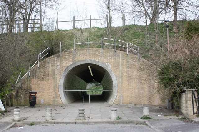
Image: © Richard Kay Taken: 1 Apr 2009
The subway has an unusual circular cross-section. The reason is that it was constructed as a tunnel with a circular tunnel boring machine. The subway connects two residential areas on either side of Kings Road, and is rather neglected.
Images are licensed for reuse under creativecommons.org/licenses/by-sa/2.0
Image Location
Latitude
53.816781
Longitude
-1.750263