Spring Street
Introduction
The photograph on this page of Spring Street by Gerald England as part of the Geograph project.
The Geograph project started in 2005 with the aim of publishing, organising and preserving representative images for every square kilometre of Great Britain, Ireland and the Isle of Man.

There are currently over 7.5m images from over 14,400 individuals and you can help contribute to the project by visiting https://www.geograph.org.uk
Spring Street
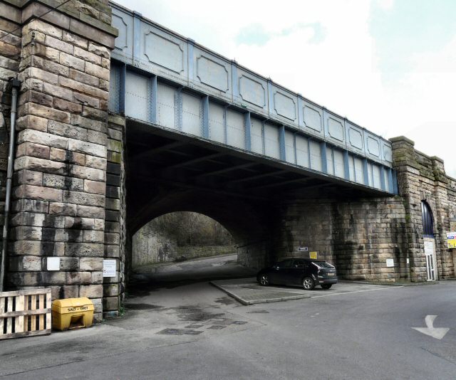
Image: © Gerald England Taken: 12 Mar 2009
Either side of the railway bridge are viaducts (leading left to Stalybridge Station; right to a tunnel) whose arches are occupied by various businesses Image
Images are licensed for reuse under creativecommons.org/licenses/by-sa/2.0
Image Location
Latitude
53.485002
Longitude
-2.059939