St Laurence Church, Eastwood
Introduction
The photograph on this page of St Laurence Church, Eastwood by Glyn Baker as part of the Geograph project.
The Geograph project started in 2005 with the aim of publishing, organising and preserving representative images for every square kilometre of Great Britain, Ireland and the Isle of Man.

There are currently over 7.5m images from over 14,400 individuals and you can help contribute to the project by visiting https://www.geograph.org.uk
St Laurence Church, Eastwood
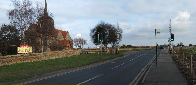
Image: © Glyn Baker Taken: 10 Feb 2006
This photo shows the proximity of St Laurence Church to Southend Airport’s runway. There is a “crash gate” on the left of the picture at the end of the churchyard wall. The barriers close when large aircraft take off or land.This photo was taken looking East.
Images are licensed for reuse under creativecommons.org/licenses/by-sa/2.0
Image Location
Latitude
51.567358
Longitude
0.683773