The Old Toll House, The Square, Scout Road, Mytholmroyd
Introduction
The photograph on this page of The Old Toll House, The Square, Scout Road, Mytholmroyd by Humphrey Bolton as part of the Geograph project.
The Geograph project started in 2005 with the aim of publishing, organising and preserving representative images for every square kilometre of Great Britain, Ireland and the Isle of Man.

There are currently over 7.5m images from over 14,400 individuals and you can help contribute to the project by visiting https://www.geograph.org.uk
The Old Toll House, The Square, Scout Road, Mytholmroyd
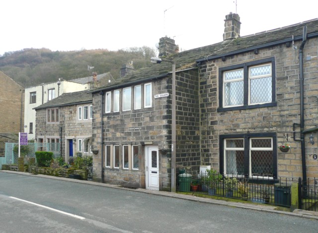
Image: © Humphrey Bolton Taken: 27 Feb 2009
An intriguing name, as I had no idea that this road (to Sowerby) had been turnpiked. It is not shown as such on the 1850 six-inch map, but that does show the name 'Bar House', although apparently referring to a building on the other side of the road. Possibly it was a very early toll road that was superseded when the present main road was constructed. The old map gives 'Square' as the name of the locality, rather than as a street name.
Images are licensed for reuse under creativecommons.org/licenses/by-sa/2.0
Image Location
Latitude
53.726799
Longitude
-1.981775