Limetree Terrace
Introduction
The photograph on this page of Limetree Terrace by David Anstiss as part of the Geograph project.
The Geograph project started in 2005 with the aim of publishing, organising and preserving representative images for every square kilometre of Great Britain, Ireland and the Isle of Man.

There are currently over 7.5m images from over 14,400 individuals and you can help contribute to the project by visiting https://www.geograph.org.uk
Limetree Terrace
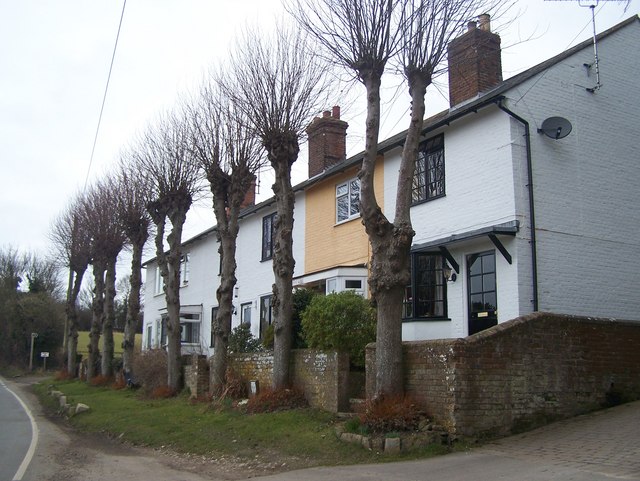
Image: © David Anstiss Taken: 22 Feb 2009
These five cottages are on a bend on Faversham Road. The lime trees are the coppiced trees in front. The North Downs Way (long distance path) goes along this short section of road then goes off road and along a farm track to follow the Pilgrims Way.
Images are licensed for reuse under creativecommons.org/licenses/by-sa/2.0
Image Location
Latitude
51.243766
Longitude
0.72249