Radio Mast, Isle of Wight Lane
Introduction
The photograph on this page of Radio Mast, Isle of Wight Lane by Rob Farrow as part of the Geograph project.
The Geograph project started in 2005 with the aim of publishing, organising and preserving representative images for every square kilometre of Great Britain, Ireland and the Isle of Man.

There are currently over 7.5m images from over 14,400 individuals and you can help contribute to the project by visiting https://www.geograph.org.uk
Radio Mast, Isle of Wight Lane
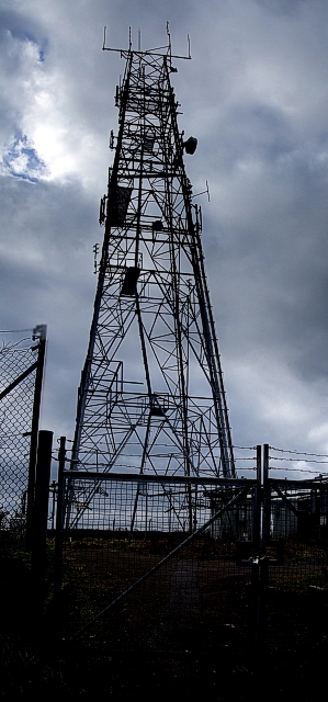
Image: © Rob Farrow Taken: 22 Feb 2009
This brooding metal structure is in its own little enclosure about half way along Isle of Wight Lane. It is specified on the maps as a radio mast, but I have no idea what station it transmits, or if it is in fact for mobile telephones - or perhaps serves both purposes. It is positioned on quite elevated ground, which rises slightly higher to the west, but falls away quite steeply to the northeast - very steeply as one encounters Image This mast's nearby twin can be seen at the top of Image]
Images are licensed for reuse under creativecommons.org/licenses/by-sa/2.0
Image Location
Latitude
51.861807
Longitude
-0.527878