Total destruction
Introduction
The photograph on this page of Total destruction by Steve Fareham as part of the Geograph project.
The Geograph project started in 2005 with the aim of publishing, organising and preserving representative images for every square kilometre of Great Britain, Ireland and the Isle of Man.

There are currently over 7.5m images from over 14,400 individuals and you can help contribute to the project by visiting https://www.geograph.org.uk
Total destruction
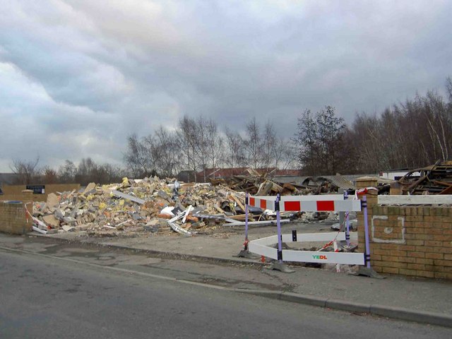
Image: © Steve Fareham Taken: 28 Dec 2008
After a recent fire and explosion (16th December 2008) the remains of what was Total 4x4 garage on Pitt Street. Residents had to be evacuated.
Images are licensed for reuse under creativecommons.org/licenses/by-sa/2.0
Image Location
Latitude
53.531375
Longitude
-1.390926