Not this way! south-east of Tregaron, Ceredigion
Introduction
The photograph on this page of Not this way! south-east of Tregaron, Ceredigion by Roger D Kidd as part of the Geograph project.
The Geograph project started in 2005 with the aim of publishing, organising and preserving representative images for every square kilometre of Great Britain, Ireland and the Isle of Man.

There are currently over 7.5m images from over 14,400 individuals and you can help contribute to the project by visiting https://www.geograph.org.uk
Not this way! south-east of Tregaron, Ceredigion
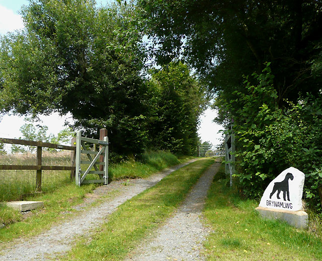
Image: © Roger D Kidd Taken: 24 Jul 2008
On all recent OS maps, including those shown on or through this page, a public footpath leads up this driveway, passes to the right of the buildings and crosses Nant Cou by way of a wooden footbridge, to Pant-glas. However, a small sign on the fence by the left gate states that the path has been legally diverted, and the yellow footpath sign can be seen pointing to the right on the post in this photograph. On entering the driveway, searching for the way on the right hand side, you will find nothing, and should you venture as far as the next gate, and wonder if the new route goes to the right there, you will still be unaware that the little yellow sign you saw actually meant, "go BACK to the road, go up the hill a hundred metres or so, and use the track across to behind the house, thence to the bridge". Now, if you do, perchance go past the gate you are standing by, you will be met by several very boisterous big black dogs who will jump up at you to greet you, and probably mean you no harm. The verbally abusive person who follows them out, however, will shout at you in very clear language, suggesting that you should, "go away, can't you ******** read? Throw your ******* map away," and such like. He is afraid of being sued if his dogs hurt anybody. No clearly visible notice is displayed giving directions to the new path, so go up the road to SN579695, take the obvious trail, bearing about 30 degrees, turn left after 100 metres (300 degrees) round the back of the buildings (where you may still meet a big black dog), then after another 100 metres, turn right down a slightly messy track to the footbridge.
Images are licensed for reuse under creativecommons.org/licenses/by-sa/2.0
Image Location
Latitude
52.204517
Longitude
-3.913145