NEARBY SCHOOL DETAILS
Totteridge Lane, HIGH WYCOMBE, HP13 7QE
Introduction
This page details the schools nearby to Totteridge Lane, HP13 7QE within a distance between 0.25 and 3 miles.
Summarised information is displayed on this page but if you want to find out more about a particular school, please click on the Details button for a full report.
Data are provided by the Department for Education.
Schools Map (3 Schools) near to Totteridge Lane, HIGH WYCOMBE, HP13 7QE
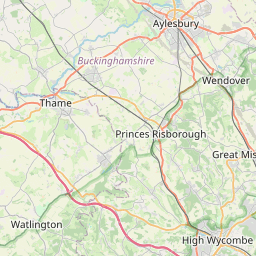

Leaflet Map data © OpenStreetMap
Notes
- Clicking on the map will re-center to the selected point.
Schools Listing (3 Schools Found) near to Totteridge Lane, HIGH WYCOMBE, HP13 7QE
School Name
Phase
Age Range
Gender
and Type
Ofsted Rating
Distance
(miles)
(miles)
2
The Royal Grammar School, High Wycombe
Type
Phase
Age
Ages 11 - 18
Gender
Score
Distance (miles)
0.7
Contains public sector information licensed under the Open Government Licence v3.0.