
Overview for Aldred Road, SHEFFIELD, S10 1PD
Summary for Aldred Road, SHEFFIELD, S10 1PD
Roadworks near S10 1PD
Road Safety near S10 1PD
Details of personal injury accidents in and around Aldred Road, S10 1PD that have been reported to South Yorkshire Police over the past 20 years.
Traffic Levels near S10 1PD
View traffic levels near Aldred Road, S10 1PD from official Department for Transport counts.
Images taken near to Aldred Road, S10 1PD and the surrounding area

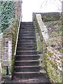
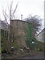
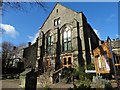
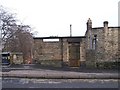
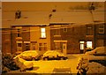
Please click the More button for more images, licensing and image copyright information.
Sheffield and nearby Videos From YouTube
Sheffield NEW Huge Building Project City Centre
Yet another building project is about halfway from completion, i the city centre. The City Centre is forever changing, with every ...
Channel: Bumpkin's Drones (View Channel)
Published: 4 Jul 2023
Police
This area is policed by South Yorkshire Police.
South Yorkshire Police split their policing area into 18 separate neighbourhoods and this postcode is in the Sheffield City Centre neighbourhood.

Sheffield City Centre Neighbourhood Crime
Top 3 Categories
For full details of all categories together with more crime information, click on the Details button.
Member of UK Parliament
This postcode is in the Sheffield, Hallam parliamentary constituency.
Sheffield, Hallam is a former constituency. It ceased to exist following the boundary change in 2024. It was located in the Yorkshire and The Humber region of England. The seat was last held by Olivia Blake (Labour) between 12 December 2019 to 30 May 2024.

Most Recent House Sales for Aldred Road, S10 1PD
13 Feb 2026
24 Nov 2025
25 Mar 2025
10 Mar 2025
Electricity Supply Emergency Code
Local Petrol Station Prices
Coordinates for S10 1PD
Residents at S10 1PD
Sunrise and Sunset at S10 1PD
Traffic Emission and Congestion Zones
Historical Weather Summary
| Clear | 19.33% |
| Cloudy | 70.64% |
| Rain | 5.48% |
| Windy | 3.89% |
| Other | 0.66% |
Population
Deprivation Index
the more deprived the postcode
Average Energy Performance
Companies Registered at S10 1PD
Postcode Details for S10 1PD
Recent Updates
|
15 Feb 2026 Schools Data Updated February 2026 |
|
4 Feb 2026 Police and Crime data updated for December 2025 |
|
31 Jan 2026 Energy Performance Certificates (England and Wales) updated December 2025 |
|
29 Jan 2026 Sold House Price data updated for December 2025 |
|
17 Jan 2026 Schools Data Updated January 2026 |
|
6 Jan 2026 Police and Crime data updated for November 2025 |
|
2 Jan 2026 Sold House Price data updated for November 2025 |
|
28 Dec 2025 Energy Performance Certificates (England and Wales) updated November 2025 |
Random Postcodes
Want an idea of what is in our extensive website? Try somewhere completely random!
The Rural/Urban classification is based upon data collected during the 2011 Census and released in August 2013 and is categorised into 6 distinct classes.
[A] Urban Major conurbation: A built up area with a population of 10,000 (3,000 in Scotland) or more and is assigned to the major conurbation settlement category.
[B] Urban Minor conurbation: A built up area with a population of 10,000 (3,000 in Scotland) or more and is assigned to the minor conurbation settlement category.
[C] Urban City and town: A built up area with a population of 10,000 (3,000 in Scotland) or more and is assigned to the city and town settlement category.
[D] Rural Town and fringe
[E] Rural Village
[F] Rural Hamlet and isolated dwelling
The Index of Multiple Deprivation (IMD) is the official measure of relative deprivation.
The index is based on 39 separate indicators across seven distinct domains (Income; Employment; Health and Disability; Education, Skills and Training; Crime; Barriers to Housing and Services; Living Environment) to provide an overall measure of multiple deprivation and is calculated for every neighbourhood.
The index is relative rather than an absolute scale and so a neighbourhood with a score of 10 is more deprived than one rated 20, but this does not equate to being twice as deprived.
Please note: Different indices are used in England, Scotland, Wales and Northern Ireland and so comparison of scores from neighbourhoods in different countries should not be undertaken.
These figures report on incorporated UK companies only that are registered at this postcode and do not include sole-traders, partnerships or overseas organisations.
The population figure shown for your area are an estimate provided by the Office for National Statistics and is rounded to the nearest 1,000.
The estimates are derived from the Annual Population Survey (APS) which is the Labour Force Survey (LFS) plus various sample boosts.
There are 36 metropolitan district councils which together cover 6 large urban areas: the counties of Greater Manchester, Merseyside, South Yorkshire, Tyne and Wear, West Midlands, and West Yorkshire.
Metropolitan districts are responsible for all services in their area, although certain conurbation wide services such as fire and civil defence, police, waste disposal and passenger transport are provided through joint authorities (the districts acting jointly).