Overview for South Esplanade West, ABERDEEN, AB11 9AA
Introduction
Aberdeen is a city in North East Scotland, and is the third most populous city in the country. Aberdeen is one of Scotland's 32 local government council areas (as Aberdeen City), and has a 2020 population estimate of 198,590 for the city of Aberdeen, and 227,560 for the local council area making it the United Kingdom's 39th most populous built-up area. The city is 93 mi (150 km) northeast of Edinburgh and 398 mi (641 km) north of London, and is the northernmost major city in the United Kingdom. Aberdeen has a long, sandy coastline and features an oceanic climate, with cool summers and mild, rainy winters.
During the mid-18th to mid-20th centuries, Aberdeen's buildings incorporated locally quarried grey granite, which may sparkle like silver because of its high mica content. Since the discovery of North Sea oil in 1969, Aberdeen has been known as the offshore oil capital of Europe. Based upon the discovery of prehistoric villages around the mouths of the rivers Dee and Don, the area around Aberdeen has been thought to have been settled for at least 6,000 years.
Aberdeen received royal burgh status from David I of Scotland (1124–1153), which transformed the city economically. The traditional industries of fishing, paper-making, shipbuilding, and textiles have been overtaken by the oil industry and Aberdeen's seaport. Aberdeen Heliport is one of the busiest commercial heliports in the world, and the seaport is the largest in the north-east part of Scotland. A university town, the city is known for the University of Aberdeen, founded in 1495 as the fifth oldest university in the English-speaking world and located in Old Aberdeen.
In 2012, HSBC named Aberdeen as a leading business hub and one of eight 'super cities' spearheading the UK's economy, marking it as the only city in Scotland so designated. In 2018, Aberdeen was found to be the best city in the UK to start a business in a study released by card payment firm Paymentsense.
Summary for South Esplanade West, ABERDEEN, AB11 9AA
Roadworks near AB11 9AA
Road Safety near AB11 9AA
Details of personal injury accidents in and around South Esplanade West, AB11 9AA that have been reported to over the past 20 years.
Traffic Levels near AB11 9AA
View traffic levels near South Esplanade West, AB11 9AA from official Department for Transport counts.
Images taken near to South Esplanade West, AB11 9AA and the surrounding area
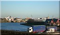
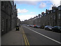
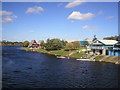
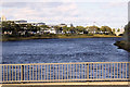
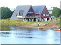
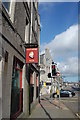
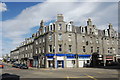
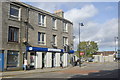
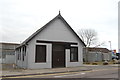
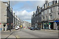
Please click the More button for more images, licensing and image copyright information.
Aberdeen and nearby Videos From YouTube
fly down Union Street aberdeen 4k drone footage
Fly down Union Street aberdeen 4k drone footage.
Channel: Craig Roy (View Channel)
Published: 22 Apr 2023
Member of UK Parliament
This postcode is in the Aberdeen South parliamentary constituency.
Aberdeen South is a constituency in Scotland. The seat has been held by Stephen Flynn (Scottish National Party) since December 2019.

Most Recent House Sales for South Esplanade West, AB11 9AA
No recorded house sales or transfers for this postcode.
Local Petrol Station Prices
Coordinates for AB11 9AA
Sunrise and Sunset at AB11 9AA
Traffic Emission and Congestion Zones
Historical Weather Summary
| Clear | 12.04% |
| Cloudy | 48.07% |
| Rain | 8.35% |
| Windy | 31.22% |
| Other | 0.32% |
Average Energy Performance
Companies Registered at AB11 9AA
Postcode Details for AB11 9AA
Recent Updates
|
18 Apr 2024 Added Traffic Camera Views from Traffic Scotland to Roadworks within Scotland |
|
15 Apr 2024 Schools Data updated for April 2024 |
|
10 Apr 2024 Companies Data updated for March 2024 |
|
7 Apr 2024 New option to receive automatic updates to roadworks that affect you |
|
7 Apr 2024 Police and Crime data updated for February 2024 |
|
3 Apr 2024 Sold House Price data updated for February 2024 |
|
30 Mar 2024 Energy Performance Certificates (England and Wales) updated February 2024 |
|
28 Mar 2024 New feature to use Geolocating functions to detect your current location |
Random Postcodes
Want an idea of what is in our extensive website? Try somewhere completely random!
The Rural/Urban classification is based upon data collected during the 2011 Census and released in August 2013 and is categorised into 6 distinct classes.
[A] Urban Major conurbation: A built up area with a population of 10,000 (3,000 in Scotland) or more and is assigned to the major conurbation settlement category.
[B] Urban Minor conurbation: A built up area with a population of 10,000 (3,000 in Scotland) or more and is assigned to the minor conurbation settlement category.
[C] Urban City and town: A built up area with a population of 10,000 (3,000 in Scotland) or more and is assigned to the city and town settlement category.
[D] Rural Town and fringe
[E] Rural Village
[F] Rural Hamlet and isolated dwelling
The Index of Multiple Deprivation (IMD) is the official measure of relative deprivation.
The index is based on 39 separate indicators across seven distinct domains (Income; Employment; Health and Disability; Education, Skills and Training; Crime; Barriers to Housing and Services; Living Environment) to provide an overall measure of multiple deprivation and is calculated for every neighbourhood.
The index is relative rather than an absolute scale and so a neighbourhood with a score of 10 is more deprived than one rated 20, but this does not equate to being twice as deprived.
Please note: Different indices are used in England, Scotland, Wales and Northern Ireland and so comparison of scores from neighbourhoods in different countries should not be undertaken.
These figures report on incorporated UK companies only that are registered at this postcode and do not include sole-traders, partnerships or overseas organisations.
The population figure shown for your area are an estimate provided by the Office for National Statistics and is rounded to the nearest 1,000.
The estimates are derived from the Annual Population Survey (APS) which is the Labour Force Survey (LFS) plus various sample boosts.
There are 55 unitary authorities. They provide all local government services in their areas. These are mainly in the cities, urban areas and larger towns although there are now 6 shire county councils that are unitary (ie have no district councils beneath them).