Overview for Balmoral Drive, HAYES, UB4 8DQ
Introduction
Hayes is a town in west London. Historically situated within the county of Middlesex, it is now part of the London Borough of Hillingdon. The town's population, including its localities Hayes End, Harlington and Yeading, was recorded in the 2021 census as 93,928. It is situated 13 miles (21 km) west of Charing Cross, or 6.5 miles (10.5 km) east of Slough. Hayes is served by the Great Western Main Line, and Hayes & Harlington railway station is on the Elizabeth line. The Grand Union Canal flows through the town centre.
Hayes has a long history. The area appears in the Domesday Book (1086). Landmarks in the area include the Grade II* listed Parish Church, St Mary's – the central portion of the church survives from the twelfth century and it remains in use (the church dates back to 830 A.
D.) – and Barra Hall, a Grade II listed manor house.
Hayes is known as the erstwhile home of EMI. The words "Hayes, Middlesex" appear on the reverse of The Beatles' albums, which were manufactured at the town's Old Vinyl Factory. The town centre's "gold disc" installation marks the fiftieth anniversary on 1 June 2017 of the Beatles' Sgt. Pepper's Lonely Hearts Club Band album, manufactured in Hayes in 1967. The town is the location of the U.
K. headquarters of companies including: Heinz, United Biscuits, Fujitsu, and Rackspace U.
K.
Notable historical residents include the early modern "father of English music", William Byrd, and a pre-eminent figure of twentieth-century English literature, George Orwell.
Summary for Balmoral Drive, HAYES, UB4 8DQ
Roadworks near UB4 8DQ
Road Safety near UB4 8DQ
Details of personal injury accidents in and around Balmoral Drive, UB4 8DQ that have been reported to Metropolitan Police Service over the past 20 years.
Traffic Levels near UB4 8DQ
View traffic levels near Balmoral Drive, UB4 8DQ from official Department for Transport counts.
Images taken near to Balmoral Drive, UB4 8DQ and the surrounding area
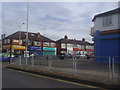
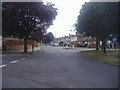

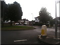
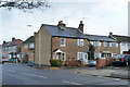
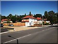
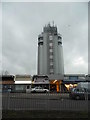
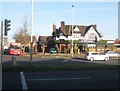
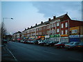
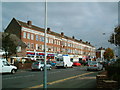
Please click the More button for more images, licensing and image copyright information.
Member of UK Parliament
This postcode is in the Hayes and Harlington parliamentary constituency.
Hayes and Harlington is a constituency in London, England. The seat has been held by John McDonnell (Labour) since May 2010.

Most Recent House Sales for Balmoral Drive, UB4 8DQ
5 Oct 2023
16 Apr 2021
9 Apr 2021
12 Mar 2021
Local Petrol Station Prices
Coordinates for UB4 8DQ
Residents at UB4 8DQ
Sunrise and Sunset at UB4 8DQ
Traffic Emission Zones
Historical Weather Summary
| Clear | 8.83% |
| Cloudy | 79.88% |
| Rain | 8.17% |
| Windy | 3.08% |
| Other | 0.04% |
Population
Deprivation Index
the more deprived the postcode
Average Energy Performance
Companies Registered at UB4 8DQ
Postcode Details for UB4 8DQ
Recent Updates
|
18 Apr 2024 Added Traffic Camera Views from Traffic Scotland to Roadworks within Scotland |
|
15 Apr 2024 Schools Data updated for April 2024 |
|
10 Apr 2024 Companies Data updated for March 2024 |
|
7 Apr 2024 New option to receive automatic updates to roadworks that affect you |
|
7 Apr 2024 Police and Crime data updated for February 2024 |
|
3 Apr 2024 Sold House Price data updated for February 2024 |
|
30 Mar 2024 Energy Performance Certificates (England and Wales) updated February 2024 |
|
28 Mar 2024 New feature to use Geolocating functions to detect your current location |
Random Postcodes
Want an idea of what is in our extensive website? Try somewhere completely random!
The Rural/Urban classification is based upon data collected during the 2011 Census and released in August 2013 and is categorised into 6 distinct classes.
[A] Urban Major conurbation: A built up area with a population of 10,000 (3,000 in Scotland) or more and is assigned to the major conurbation settlement category.
[B] Urban Minor conurbation: A built up area with a population of 10,000 (3,000 in Scotland) or more and is assigned to the minor conurbation settlement category.
[C] Urban City and town: A built up area with a population of 10,000 (3,000 in Scotland) or more and is assigned to the city and town settlement category.
[D] Rural Town and fringe
[E] Rural Village
[F] Rural Hamlet and isolated dwelling
The Index of Multiple Deprivation (IMD) is the official measure of relative deprivation.
The index is based on 39 separate indicators across seven distinct domains (Income; Employment; Health and Disability; Education, Skills and Training; Crime; Barriers to Housing and Services; Living Environment) to provide an overall measure of multiple deprivation and is calculated for every neighbourhood.
The index is relative rather than an absolute scale and so a neighbourhood with a score of 10 is more deprived than one rated 20, but this does not equate to being twice as deprived.
Please note: Different indices are used in England, Scotland, Wales and Northern Ireland and so comparison of scores from neighbourhoods in different countries should not be undertaken.
These figures report on incorporated UK companies only that are registered at this postcode and do not include sole-traders, partnerships or overseas organisations.
The population figure shown for your area are an estimate provided by the Office for National Statistics and is rounded to the nearest 1,000.
The estimates are derived from the Annual Population Survey (APS) which is the Labour Force Survey (LFS) plus various sample boosts.
There are 32 London boroughs. They provide nearly all the services in their area. However, the Greater London Authority (GLA) provides London-wide government, including special responsibility for police, fire, strategic planning and transport.