Overview for Arlington Road, TWICKENHAM, TW1 2AX
Introduction
Twickenham is a suburban district in London, England. It is situated on the River Thames 9.9 miles (15.9 km) southwest of Charing Cross. Historically part of Middlesex, it has formed part of the London Borough of Richmond upon Thames since 1965, and the borough council's administrative headquarters are located in the area.
The population, including St Margarets and Whitton, was 62,148 at the 2011 census.
Twickenham is the home of the Rugby Football Union, with hundreds of thousands of spectators visiting Twickenham Stadium each year. The historic riverside area has a network of 18th-century buildings and pleasure grounds, many of which have survived intact.
This area has three grand period mansions with public access: York House, Marble Hill and Strawberry Hill House. Another has been lost, that belonging to 18th-century aphoristic poet Alexander Pope, who was known as the Bard of Twickenham. Strawberry Hill, the Neo-Gothic prototype home of Horace Walpole is linked with the oldest Roman Catholic university in the country, St Mary's University.
Summary for Arlington Road, TWICKENHAM, TW1 2AX
Roadworks near TW1 2AX
Road Safety near TW1 2AX
Details of personal injury accidents in and around Arlington Road, TW1 2AX that have been reported to Metropolitan Police Service over the past 20 years.
Traffic Levels near TW1 2AX
View traffic levels near Arlington Road, TW1 2AX from official Department for Transport counts.
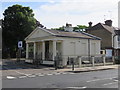
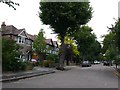
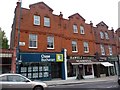
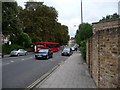
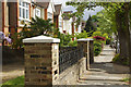
Images taken near to Arlington Road, TW1 2AX and the surrounding area

![St Margarets buildings [3]](https://s2.geograph.org.uk/geophotos/07/04/22/7042218_080a26d9_120x120.jpg)

![St Margarets features [1]](https://s2.geograph.org.uk/geophotos/07/04/22/7042222_58c08986_120x120.jpg)
![St Margarets buildings [2]](https://s1.geograph.org.uk/geophotos/07/04/22/7042213_e180a5ce_120x120.jpg)
Please click the More button for more images, licensing and image copyright information.
Member of UK Parliament
This postcode is in the Twickenham parliamentary constituency.
Twickenham is a constituency in London, England. The seat has been held by Munira Wilson (Liberal Democrat) since December 2019.

Most Recent House Sales for Arlington Road, TW1 2AX
8 Feb 2024
30 Jun 2022
19 Mar 2021
4 Dec 2020
Local Petrol Station Prices
Coordinates for TW1 2AX
Residents at TW1 2AX
Sunrise and Sunset at TW1 2AX
Traffic Emission Zones
Historical Weather Summary
| Clear | 9.13% |
| Cloudy | 80.67% |
| Rain | 8.21% |
| Windy | 1.96% |
| Other | 0.03% |
Population
Deprivation Index
the more deprived the postcode
Average Energy Performance
Companies Registered at TW1 2AX
Postcode Details for TW1 2AX
Recent Updates
|
18 Apr 2024 Added Traffic Camera Views from Traffic Scotland to Roadworks within Scotland |
|
15 Apr 2024 Schools Data updated for April 2024 |
|
10 Apr 2024 Companies Data updated for March 2024 |
|
7 Apr 2024 New option to receive automatic updates to roadworks that affect you |
|
7 Apr 2024 Police and Crime data updated for February 2024 |
|
3 Apr 2024 Sold House Price data updated for February 2024 |
|
30 Mar 2024 Energy Performance Certificates (England and Wales) updated February 2024 |
|
28 Mar 2024 New feature to use Geolocating functions to detect your current location |
Random Postcodes
Want an idea of what is in our extensive website? Try somewhere completely random!
The Rural/Urban classification is based upon data collected during the 2011 Census and released in August 2013 and is categorised into 6 distinct classes.
[A] Urban Major conurbation: A built up area with a population of 10,000 (3,000 in Scotland) or more and is assigned to the major conurbation settlement category.
[B] Urban Minor conurbation: A built up area with a population of 10,000 (3,000 in Scotland) or more and is assigned to the minor conurbation settlement category.
[C] Urban City and town: A built up area with a population of 10,000 (3,000 in Scotland) or more and is assigned to the city and town settlement category.
[D] Rural Town and fringe
[E] Rural Village
[F] Rural Hamlet and isolated dwelling
The Index of Multiple Deprivation (IMD) is the official measure of relative deprivation.
The index is based on 39 separate indicators across seven distinct domains (Income; Employment; Health and Disability; Education, Skills and Training; Crime; Barriers to Housing and Services; Living Environment) to provide an overall measure of multiple deprivation and is calculated for every neighbourhood.
The index is relative rather than an absolute scale and so a neighbourhood with a score of 10 is more deprived than one rated 20, but this does not equate to being twice as deprived.
Please note: Different indices are used in England, Scotland, Wales and Northern Ireland and so comparison of scores from neighbourhoods in different countries should not be undertaken.
These figures report on incorporated UK companies only that are registered at this postcode and do not include sole-traders, partnerships or overseas organisations.
The population figure shown for your area are an estimate provided by the Office for National Statistics and is rounded to the nearest 1,000.
The estimates are derived from the Annual Population Survey (APS) which is the Labour Force Survey (LFS) plus various sample boosts.
There are 32 London boroughs. They provide nearly all the services in their area. However, the Greater London Authority (GLA) provides London-wide government, including special responsibility for police, fire, strategic planning and transport.