Overview for North Road, LLANYMYNECH, SY22 6EA
Introduction
Llanymynech is a village and former civil parish straddling the border between Montgomeryshire/Powys, Wales, and Shropshire, England, about 9 miles (14 km) north of the Welsh town of Welshpool. The name is Welsh for "Church of the Monks". The village is on the banks of the River Vyrnwy, and the Montgomery Canal passes through it.
The border runs for the most part along the frontages of the buildings on the east (English) side of the village's main street, with the eastern half of the village in England and the western half in Wales. The Church of England parish church of St Agatha lies just in England, although the entire village lies in the same ecclesiastical parish. The border also passed right through the now closed Lion pub, which had two bars in Shropshire and one in Montgomeryshire. At one time Welsh counties were referred to as "wet" or "dry" depending on whether people could drink in pubs on Sundays. When Montgomeryshire was dry it was legal to drink on Sundays in the two English bars of the Lion but not the Welsh bar. Two of the remaining open pubs in the village are entirely in England and the third is entirely in Wales.
Just to the north of the village is Pant. Further north is the English market town of Oswestry. The community of Llanymynech and Pant had a population of 1,675 as of the 2011 census.
Summary for North Road, LLANYMYNECH, SY22 6EA
Roadworks near SY22 6EA
Road Safety near SY22 6EA
Details of personal injury accidents in and around North Road, SY22 6EA that have been reported to West Mercia Police over the past 20 years.
Traffic Levels near SY22 6EA
View traffic levels near North Road, SY22 6EA from official Department for Transport counts.
Images taken near to North Road, SY22 6EA and the surrounding area
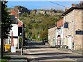

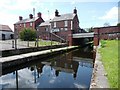

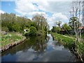
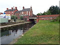
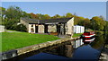
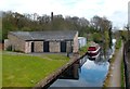
Please click the More button for more images, licensing and image copyright information.
Police
This area is policed by West Mercia Police.
West Mercia Police split their policing area into 82 separate neighbourhoods and this postcode is in the Oswestry Rural South neighbourhood.

Oswestry Rural South Neighbourhood Crime
Top 3 Categories
For full details of all categories together with more crime information, click on the Details button.
Member of UK Parliament
This postcode is in the North Shropshire parliamentary constituency.
North Shropshire is a constituency in the West Midlands region of England. The seat has been held by Helen Morgan (Liberal Democrat) since December 2021.

Most Recent House Sales for North Road, SY22 6EA
17 Oct 2022
23 Apr 2021
27 Jul 2017
9 Sep 2016
Local Petrol Station Prices
Coordinates for SY22 6EA
Residents at SY22 6EA
Sunrise and Sunset at SY22 6EA
Traffic Emission and Congestion Zones
Historical Weather Summary
| Clear | 18.36% |
| Cloudy | 68.59% |
| Rain | 7.20% |
| Windy | 5.70% |
| Other | 0.15% |
Population
Deprivation Index
the more deprived the postcode
Average Energy Performance
Companies Registered at SY22 6EA
Postcode Details for SY22 6EA
Recent Updates
|
18 Apr 2024 Added Traffic Camera Views from Traffic Scotland to Roadworks within Scotland |
|
15 Apr 2024 Schools Data updated for April 2024 |
|
10 Apr 2024 Companies Data updated for March 2024 |
|
7 Apr 2024 New option to receive automatic updates to roadworks that affect you |
|
7 Apr 2024 Police and Crime data updated for February 2024 |
|
3 Apr 2024 Sold House Price data updated for February 2024 |
|
30 Mar 2024 Energy Performance Certificates (England and Wales) updated February 2024 |
|
28 Mar 2024 New feature to use Geolocating functions to detect your current location |
Random Postcodes
Want an idea of what is in our extensive website? Try somewhere completely random!
The Rural/Urban classification is based upon data collected during the 2011 Census and released in August 2013 and is categorised into 6 distinct classes.
[A] Urban Major conurbation: A built up area with a population of 10,000 (3,000 in Scotland) or more and is assigned to the major conurbation settlement category.
[B] Urban Minor conurbation: A built up area with a population of 10,000 (3,000 in Scotland) or more and is assigned to the minor conurbation settlement category.
[C] Urban City and town: A built up area with a population of 10,000 (3,000 in Scotland) or more and is assigned to the city and town settlement category.
[D] Rural Town and fringe
[E] Rural Village
[F] Rural Hamlet and isolated dwelling
The Index of Multiple Deprivation (IMD) is the official measure of relative deprivation.
The index is based on 39 separate indicators across seven distinct domains (Income; Employment; Health and Disability; Education, Skills and Training; Crime; Barriers to Housing and Services; Living Environment) to provide an overall measure of multiple deprivation and is calculated for every neighbourhood.
The index is relative rather than an absolute scale and so a neighbourhood with a score of 10 is more deprived than one rated 20, but this does not equate to being twice as deprived.
Please note: Different indices are used in England, Scotland, Wales and Northern Ireland and so comparison of scores from neighbourhoods in different countries should not be undertaken.
These figures report on incorporated UK companies only that are registered at this postcode and do not include sole-traders, partnerships or overseas organisations.
The population figure shown for your area are an estimate provided by the Office for National Statistics and is rounded to the nearest 1,000.
The estimates are derived from the Annual Population Survey (APS) which is the Labour Force Survey (LFS) plus various sample boosts.
There are 55 unitary authorities. They provide all local government services in their areas. These are mainly in the cities, urban areas and larger towns although there are now 6 shire county councils that are unitary (ie have no district councils beneath them).